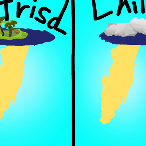
The difference between islands and continents – In simple terms, islands and continents clearly have different meanings and concepts from one another. The most specific difference is that islands are smaller in area than continents. Usually islands are within one country, while continents can be home to several countries.
Does Sinaumed’s still feel confused about understanding these two things? If so, let’s look at some of the following about the differences between countries and continents!
Definition of Islands and Continents
Definition of Island
According to the UN Convention on The Law of The Sea (UNCLOS 1982) Article 121, states that an island is a naturally formed land mass that is surrounded by water and does not sink during high tides.
Meanwhile, an island is usually different from small islands scattered in each country. According to Law number 27 of 2007 concerning the Management of Coastal Areas and Small Islands, an island is called small if it has an area of around 2000 km² or around 200,000 hectares.
UNCLOS 1982 provides conditions regarding the definition of an island, namely an island must be formed naturally. This means that artificial islands or islands resulting from reclamation cannot be included in the category of an island.
Definition of Continent
According to KBBI, the continent is a part of the earth in the form of land or land that is very broad so that the central part of the continent is not directly affected by sea breezes.
The existence of continents in the form of land or large land masses can make continents a “home” for several countries.
Elements of Islands and Continents
Island Elements
- A land surrounded by oceans
- Can be inhabited by a group of humans
- It’s in a country
- The extent varies
Continental Elements
In general, a continent has several elements, namely,
- The area is very wide and bounded by the sea
- Each has its own geographic location
- Determined by geology
- Becoming a “home” place for several countries
Islands and Continents
Island shape
Islands have various forms. Some are inhabited and some are in remote locations making it impossible for a group of humans to live in. Indonesia, which is often dubbed as an archipelagic country, has around 17,000 islands.
The shape of the islands scattered in Indonesia has a unique shape. Like Sulawesi Island which has a shape like the letter K, and others.
The shape of these islands occurs naturally without human intervention. However, there are artificial islands that are created by humans for certain purposes. Making the island using materials such as soil, sand, rock, concrete, and others. An example of an artificial island in Indonesia is the Reclamation Island in Jakarta.
According to the Ministry of Marine Affairs and Fisheries, there are a total of 8,837 (53.01%) small islands whose land area is only 0 – 1 Ha, so these islands cannot be used for investment purposes. However, these small islands can be used for conservation, education, research, to the defense and security of a country.
In Indonesia, the number of small islands is 5,594 consisting of 3,862 islands with utilization in the form of other use areas (APL) and are uninhabited. While the rest, which is around 1,732, are inhabited small islands.
Continental Shape
On this planet earth, continents have seven forms, each of which is home to many countries. The seven continents are Asia, Africa, North America, South America, Australia, Europe and Antarctica.
1. Continent of Asia
The continent of Asia is the largest continent on planet Earth, which is approximately 43,998,920 square kilometers. In addition, the continent of Asia is known as the continent that has the most population in the world.
Viewed astronomically, the Asian continent is located at 26 degrees – 170 degrees East Longitude (BT) and 11 degrees – 80 degrees South Latitude (LS).
Meanwhile, the continent of Asia has its own boundaries, ie
North: Arctic Ocean
East: Pacific Ocean, Bering Strait and Bering Sea
South: Indian Ocean and Australia
West: Europe, Ural Mountains, Red Sea, Coconut Sea, Bosphorus and Dardanelles. (OL-1)
The continent of Asia is divided into six regions namely Southeast Asia, East Asia, South Asia, West Asia, Central Asia and North Asia.
The Asian continent has deserts and lots of tropical rain forests. The desert on this continent is very wide and is located in India, China, and parts of the Middle East. While the existence of tropical rain forests is usually located in southeastern Asia, namely in the Philippines, Indonesia and Malaysia.
In addition, on the Asian continent there are also many savannas and steppes. Savanna is a wide expanse of grassland with trees around it. Meanwhile, the steppe is a wide and dry expanse of land so that you can find lots of shrubs. Savanna and steppe are common in the Central Asian region because in this region the rainfall is quite low.
2. Continent of Africa
The African continent is the third largest continent in the world with an area of approximately ± 30,290,000 km2. The African continent is famous for its inhabitants who are descended from negroes or black races.
Astronomically the continent of Africa is located between 37º latitude – 34º south latitude and 17º West – 51º east longitude. Thus it can be concluded that the continent of Africa is traversed by the equator and most of its land area is in the northern hemisphere.
The continent of Africa has its own boundaries as well as other continents, ie
North : Mediterranean Sea (Mediterranean Sea)
East: Indian Ocean, Red Sea
To the south: the Atlantic Ocean
West: Atlantic Ocean
This continent has many major rivers. The longest river in the world, the Nile, which is about 6,400 km long, is also located on this continent. Because of its length, the Nile River passes through the countries of Sudan and Egypt.
The types of animals that live on this continent are a combination of various types of typical Eurasian animals, which generally have the characteristic of being large and strong bodies such as lions, giraffes, zebras, hyenas, and others.
3. Continent of North America
The American continent was originally discovered by a European explorer named Christopher Columbus in 1492. The American continent is divided into North America and South America based on the culture contained in each.
The area of this continent is about 19,348,760 square kilometers. The North American continent has become home to several countries, namely the United States, Canada and Mexico. Astronomically, the continent of North America is located at 26 degrees LU – 80 degrees LU and 68 degrees West – 162 degrees West.
The boundaries of the continent of North America are
North: Arctic Ocean
East: Atlantic Ocean
South: Central America and the Gulf of Mexico
West: Pacific Ocean, Bering Sea, and Bering Strait.
4. Continent of South America
South America has a culture that is thick with Latin culture from Spain and Portugal, so it is often called Latin America.
The area of this continent is about 17,867,308 square kilometers. Astronomically, the South American continent is located at 16 degrees LU –56 degrees LU and 34 degrees West – 118 degrees West.
The boundaries of the South American continent are:
North: Caribbean Sea and Atlantic Ocean
East Atlantic Ocean
South: Drake Strait and Atlantic Ocean
West: Pacific Ocean.
This continent has 4 different climates based on the location in each region, namely polar climate, subtropical climate, tropical climate, and desert climate.
a) Polar climate. When this climate comes, it will make the winters long and the summers short. As a rule, this climate occurs in the northern regions.
b) Subtropical climate. When this climate comes, this continent will experience four seasons in the form of winter, spring, summer and autumn. This climate usually affects the northernmost areas the most.
c) Tropical climate. This climate has the characteristics of high rainfall and humidity, as well as hot temperatures throughout the year. This climate usually occurs in Central America and South America.
d) Desert climate. This climate occurs with rapid temperature changes and low rainfall. This climate generally occurs in areas that are behind the mountains.
5. Continental Australia
The continent of Australia is the smallest continent in the world. The continent of Australia is often dubbed as a continent country because it only has one country in its territory. But apparently, this continent has 6 states. This continent is located quite close to the country of Indonesia, namely as the southern border of Indonesia.
The continent of Australia has an area of around 7,686,850 square kilometers. This continent is astronomically located on the lines: 113 degrees – 155 degrees East longitude and 10 degrees – 43 degrees South latitude.
Australia Continental Boundaries:
West: Indian Ocean (Indonesian Ocean)
East: Pacific Ocean
North: East Sea and Arafuru Sea
South: Indian Ocean
These animals that are spread across the Australian continent cannot usually be found in other regions. The most famous animals are kangaroos and koalas. In addition, this Australian continent has unique animals such as the platypus and pangolin.
The people who live on this continent have high quality human resources. In fact, the life expectancy of the population shows a high category alias has good health conditions with balanced welfare.
6. Continental Europe
The European continent is a combination of several peninsulas, namely mainland Europe and Scandinavia, connected by the Baltic Sea.
When viewed astronomically, this continent is located between latitude 35 degrees – 71°06 North Latitude and 9°27′ West Longitude -66°20’East Longitude.
European Continental Boundaries
North: Arctic Ocean
To the East: Continent of Asia
To the south: the Mediterranean Sea and the Black Sea
West: Atlantic Ocean
The continent is divided into five regions namely Northern Europe, Eastern Europe, Western Europe, Southern Europe and Central Europe.
The development of flora and fauna on the European Continent is a type of flora and fauna that can live in temperate and cold climates. The most famous types of flora are maple, lily, olive, oak and conifer trees. This conifer plant is a needle-leaved plant and when autumn comes, this plant will drop its leaves.
7. Continent of Antarctica
The continent of Antarctica is a continent that is not inhabited by humans because it is cold, even the whole area is covered with snow. This continent is included in the category of the coldest places in the world and is located at the South Pole of planet Earth.
This continent has an area of about 15,540,000 square kilometers. Astronomically, it is located at 66.5 – 90 LS.
Antarctica Continent Location: 66.5 – 90 South Latitude
Location of the continent of Antarctica: 15,540,000 km / square
The continent of Antarctica is bounded by the Atlantic Ocean, Indian Ocean and Pacific Ocean.
The continent of Antarctica has a landscape in the form of land which is always covered with ice with a thickness of up to 3 km. On this continent there are giant ice mountains called the Transantarctic Mountains which are about 5,000 km long. The Transantarctic Mountains divide this continent into East Antarctica and West Antarctica.
Because it is the coldest place in the world, it is only natural that this continent has the lowest temperature reaching -89 C and the average temperature is around -37 C. This is because the continent of Antarctica consists of high mountains with its land covered in cold snow. So that the population of flora and fauna that can live on this continent are only mosses, seals, penguins, and Albratas birds.